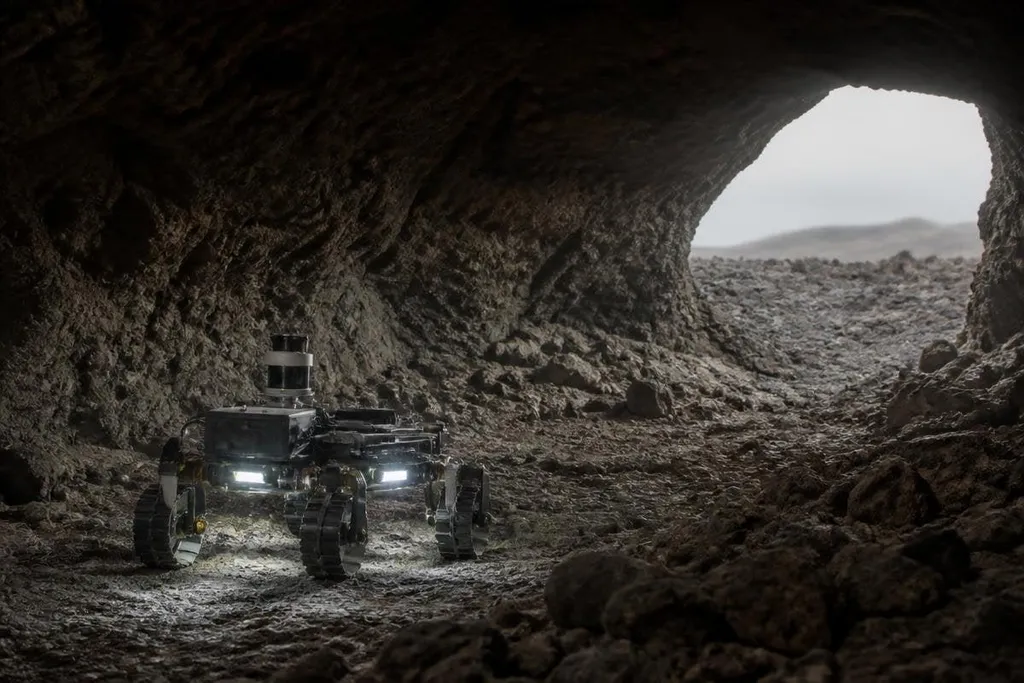
A cave robot on Mars or the Moon would lose contact with Earth as soon as rock blocked its radio signal. It would need to map dark ground, avoid drops, manage dust, and keep working without a person steering each move.
- A tether can carry power and data into a cave.
- LiDAR and cameras can build a map in darkness.
- The hardest problem is recovery after a fall or lost signal.
Why caves are useful places to search
Caves may offer protection from radiation, micrometeorites, and wide temperature swings at the surface. That makes them useful places to inspect when a mission needs a safer route or a sheltered site for instruments.
A cave can also preserve material from the surface. Dust, ice, minerals, or signs of past water might collect in cracks and shaded chambers. A robot could reach these areas without sending a person into a space where a single mistake may end the mission.
The robot would need a clear task before it entered. Mapping a passage needs different tools from collecting a rock sample, and a machine built for one job may struggle with the other.
How the robot could find its way
A rover near the entrance could use cameras, a depth sensor, and an inertial measurement unit. The sensor measures distance and shape, while the inertial unit records changes in movement when the robot travels over rough ground.
LiDAR can add a second map of the cave. It sends out laser pulses and measures their return time, giving the robot a view of walls and openings even when visible light is poor. Dust can weaken that view, so the robot would need more than one way to judge its position.
Radio contact creates the next problem. Rock blocks signals, and a cave may turn sharply after the entrance. Small relay units could sit along the route and pass data back toward the surface.
A physical tether could do the same job while also carrying power, though it may snag on rocks or limit the robot's range. For this reason, cave robots will need a local map and rules for safe movement.
If the radio link drops, the robot should stop, reverse along its known path, or wait for a relay signal. It can't depend on a controller on Earth for every wheel movement because the signal delay makes close control too slow.
Wheels, legs, or a flying robot
Wheels use less power than legs and can carry more equipment over firm ground. Loose soil, steep slopes, and broken rock change that choice. A wheel can spin in dust, while a leg can place its foot around an obstacle but uses more motors and control software.
A small flying robot could inspect ceilings, shafts, or gaps that a rover cannot reach. Its propellers would stir dust, and flight would consume stored power quickly. A drone also needs a way to return, land, and recharge inside a place where satellite navigation will not work.
I’d send a tethered rover before a free-flying drone. The tether adds a mechanical problem, but it gives the team a known route home and a steady link to the surface.
Those limits are worth tracking in robotics mission reporting, where the useful details are the rover’s link range, power budget, and recovery plan.
What can stop the mission
Darkness is only one limit. Dust can cover cameras, clog joints, and reduce the output of solar panels. Cold can cut battery performance, while heat from motors and electronics may build up in a sealed space.
A robot must also know when its map is wrong. A loose stone may move under a wheel, changing the robot's position. A narrow passage may look open in a camera image but leave no room for the robot body or its tether.
Recovery plans matter as much as driving. The robot could carry a winch, use a second vehicle, or lower itself with a tether. Each option adds weight, power use, and another part that can fail.
The unproven part is long-range autonomy in a cave that the robot has never seen. A test site on Earth can copy loose soil or low light, but it cannot prove that every failure mode has been found.
A practical choice guide
Before selecting a cave robot, check these points:
- Map first: confirm that the robot has LiDAR, depth sensing, or another method for building a local map.
- Plan the link: decide where relay units or a tether will sit before the robot leaves the entrance.
- Check recovery: give the robot a way to reverse, winch, climb, or call a second vehicle.
- Protect the sensors: test camera covers, motor seals, and dust control against the target ground.
- Set a return rule: stop the mission when power, link quality, or map confidence drops below a chosen limit.
A useful cave mission may begin with a short mapping run rather than a search for samples. If the robot can return with a reliable map, the next machine can carry better tools and take greater risks without sending a person into the dark.